About This Quiz
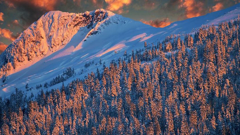
The United States of America has evolved from a few small colonies on the East Coast to a vast stripe across the continent. It contains broad mountain ranges, unending swamps, deadly deserts, rolling hills and plains as far as the eye can see. It has volcanoes, fault lines and ancient lakes. With so much land, the U.S. has an endless supply of fascinating geographic features, and not all of those geographic features are natural. The U.S. government and private industry have changed the physical face of the land in ways unimaginable at the time of its founding.
Knowing the geography one encounters daily is difficult enough! Remembering that of the whole nation is a truly epic challenge. It means thinking of the land first as a place free of state lines and names but as a place of shapes and natural forces. Our understanding of American geography has changed over the years, as science refines its point of view on things as diverse as the formations of canyons and the place of ancient seas. America cries out to be known! Can you rise to the challenge and ace this geography quiz?
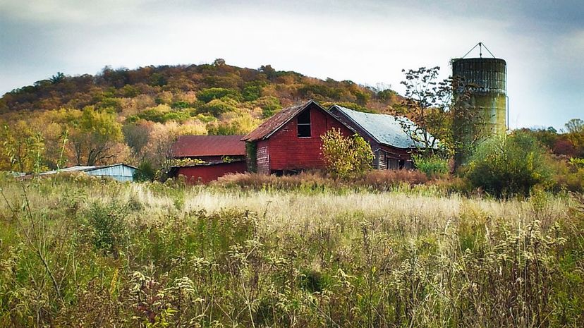
For a long time, New Jersey was farmland that provided much needed agricultural goods to east coast states. As a result, it earned its nickname, "The Garden State".
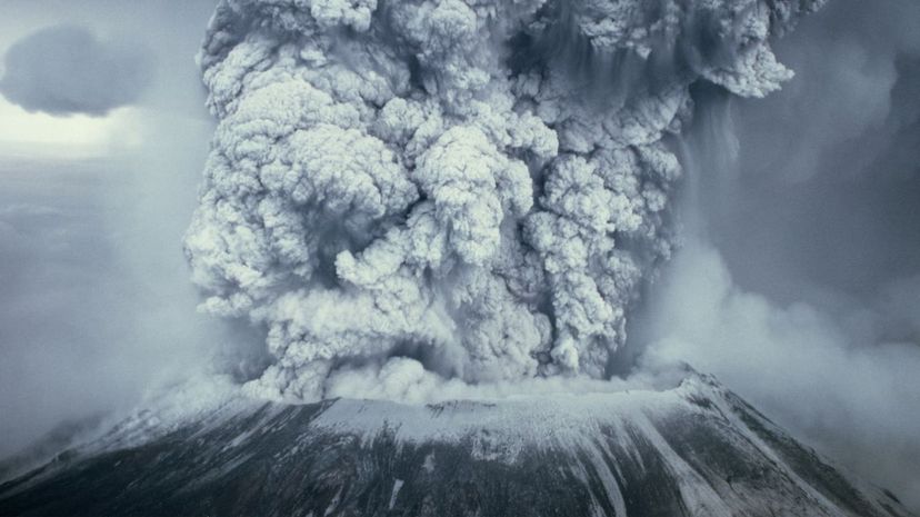
While by no means the largest volcano in the U.S., Mount St. Helens remains one of the nation's most dangerous. On May 18, 1980, geologic forces caused the mountain to crack, releasing a pyroclastic flow which knocked down trees for 230 square miles and traveled at 300 mph.
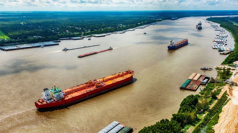
The mighty Mississippi was one of the nation's first major "highways" as it was used to transport goods from the industrial north to ports on the Gulf Coast. It starts in Lake Itaska, Minnesota and finishes up in New Orleans, Louisiana.
Advertisement
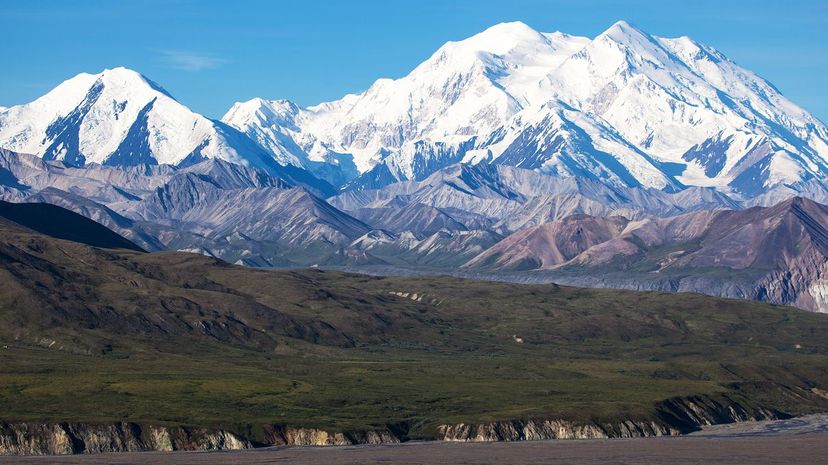
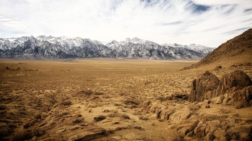
With a towering height of 20,310 feet above sea level, Denali is the tallest mountain in the United States. Located in Alaska, Denali is among the top-ten tallest mountains in the U.S., all of which are in Alaska! The tallest in the lower 48 states is Mount Whitney.
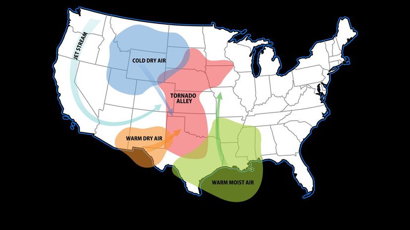
Though not a technical term, Tornado Alley has been popularly defined as including Nebraska, Missouri, Iowa, the Dakotas, Texas, Oklahoma and, most famously, Kansas. The Great Plains are well known for having just the right composition needed to produce tornadoes.
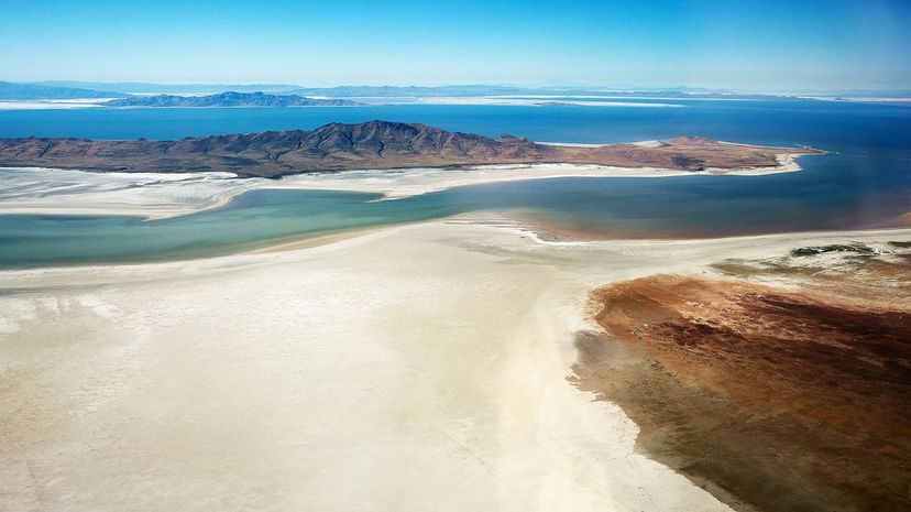
The Great Salt Lake is, unlike the rest of these, an endorheic basin. An endorheic basin is essentially a lake that has no outflowing element, so it waxes and wanes based on rainfall and evaporation. The Great Salt Lake is the largest of these in the nation, and none of these other bodies are at all.
Advertisement
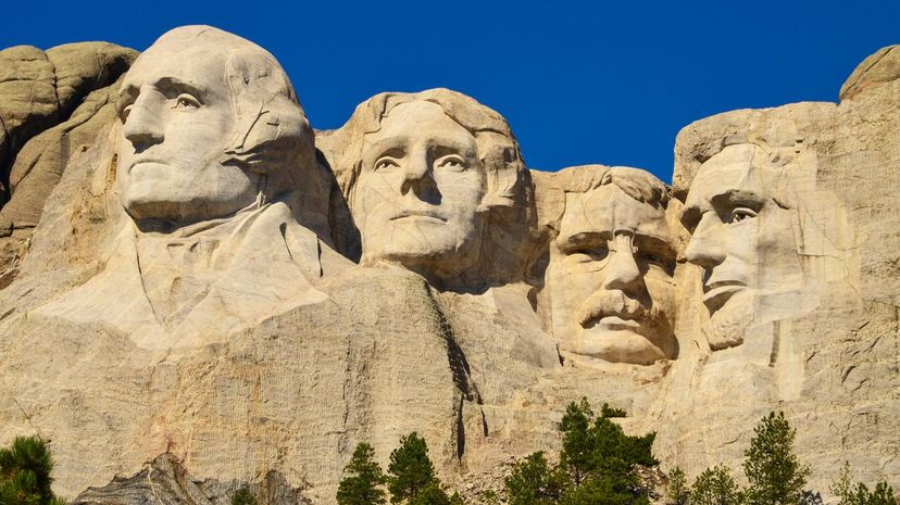
The carvings are located in Keystone, South Dakota, in the Black Hills of the Lakota Sioux. The original plan for Mount Rushmore was to carve full-length figures out of the mountainside. Inasmuch as the monument is carved into a sacred mountain, a monument to the First Nations is in progress on a nearby mountain, the work of a single man.
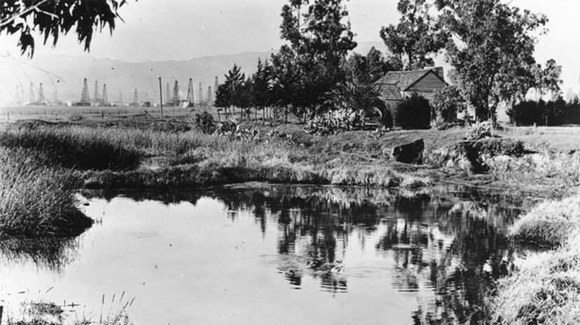
Los Angeles may be a busy metropolis, but underground, it is unique among American cities. It has oil, as anyone who has seen its nodding donkeys will attest, and it was the site of a massive tar pit in the age of dinosaurs in which various ancient creatures found themselves trapped. You can visit the pits today (shown here in 1910) and see them still bubbling away, and you can see the remains found there preserved in museums.
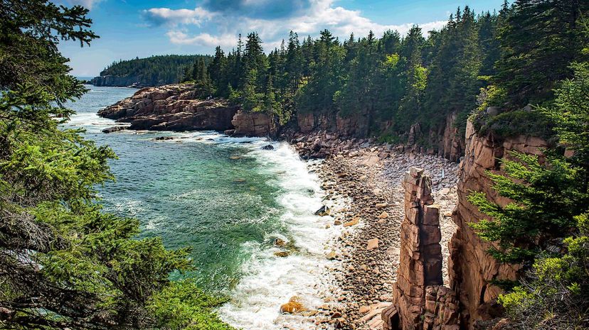
Encompassing the tallest east coast mountains, Acadia National Park consists mostly of the islands off the coast of Maine, including Mount Desert Island. It is all the best natural sights and experienced in Maine, except perhaps for ski mountains.
Advertisement
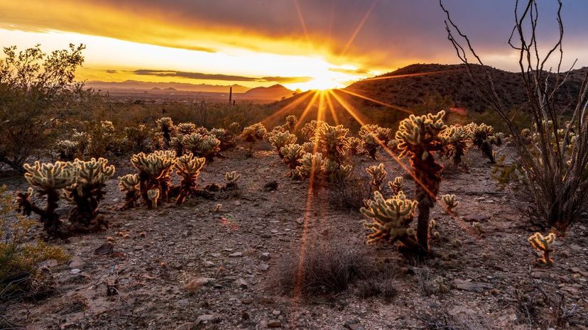
For the most part, the deserts of the Southwest qualify, unsurprisingly, as hot-and-dry deserts. That said, unlike the image, many have of desert lands like those in the Middle East. Southwestern deserts are not all sand dunes and desolation. In fact, they're teeming with life!
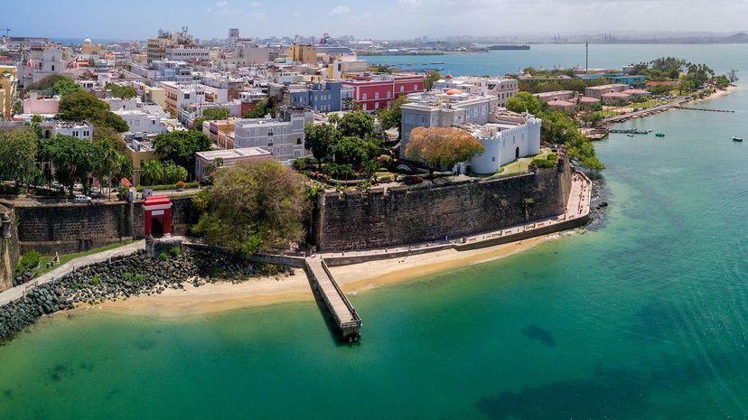
San Juan is unique in that it is populated almost entirely by U.S. citizens, as all Puerto Ricans are U.S. citizens, and as a U.S. territory, it counts for the purpose of this question. San Juan is the island nation's largest city.
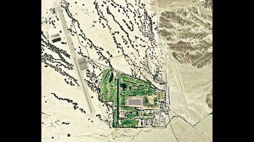
Furnace Creek Airport is the lowest airport or airfield in the United States, at an elevation of 210 feet below sea level. By comparison, the bottom of Lake Superior is 732 feet below sea level.
Advertisement
National parks come in all shapes and sizes and all over the land the USA is responsible for. Big Bend is more or less what one imagines when one thinks of a national park, and it's located in Texas. The Gateway Arch is a small national park, to take care of the monument. American Samoa was established as a national park to protect its environment. Central Park is not a national park.
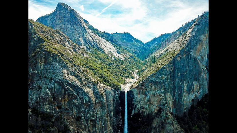
Yosemite National Park is located in eastern California. Containing some of the most jaw-dropping views of any national park, it sees millions of visitors every year, attracted by its mountains and iconic giant sequoia.
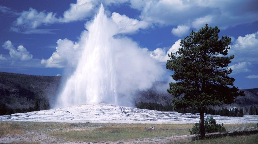
Yellowstone National Park's famous geyser "Old Faithful" is powered by chambers in the ground filled with water, heated by magma in chambers in the crust. The entire park is a giant volcano, but don't worry! It last erupted in 664,000 years ago.
Advertisement
The Ramapo Seismic Zone, which runs through New York, New Jersey and Pennsylvania, had its last major quake in 1884, a 5.5. With sections running from the outer boroughs through Manhattan at 125th Street, the city tried to build its infrastructure with this in mind, but given their knowledge of earthquakes at the time, these landmarked structures are designed to be destroyed.
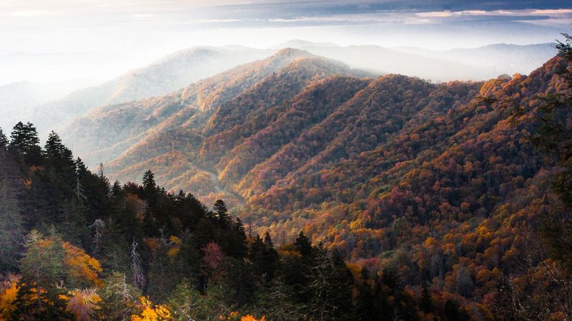
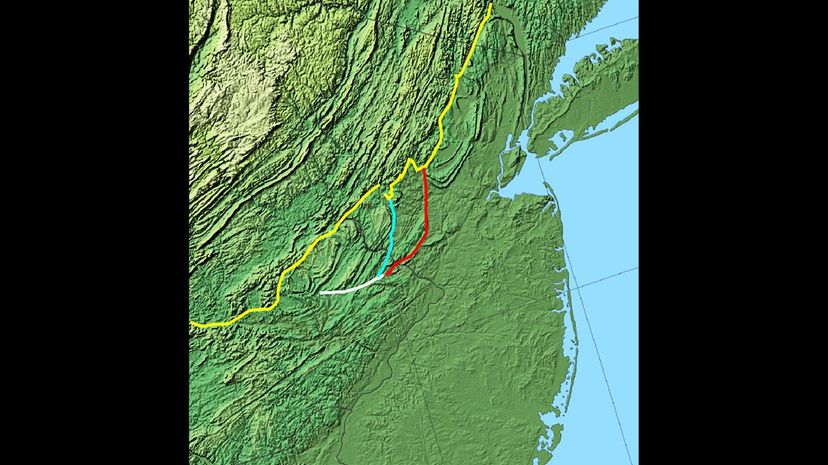
The Appalachian Mountains are a huge range, stretching from the south up through Maine. They include the Berkshires, the Blue Ridge Mountains, the Great Smoky Mountains, the Green Mountains, the Longfellow Mountains and the White Mountains,
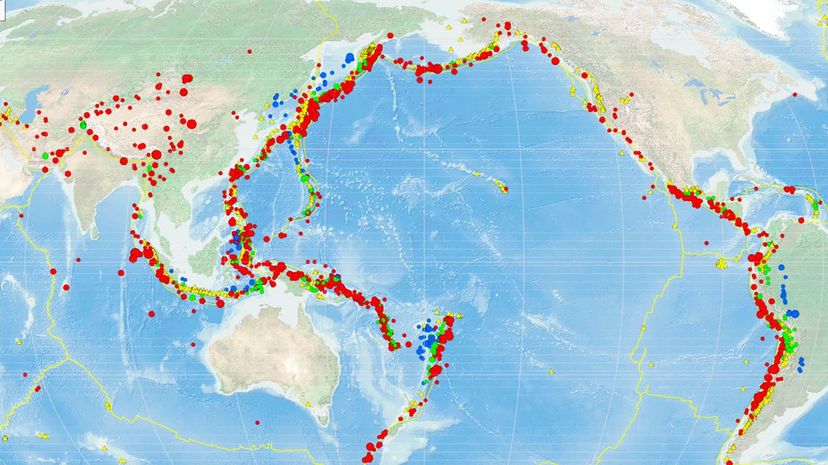
The Ring of Fire is the name given to the circle of volcanoes surrounding the Pacific Ocean. The Ring of Fire includes volcanoes formed in Russia, Japan, Alaska, Canada, the lower 48 states, South America and various South Pacific atolls and islands.
Advertisement
While Oregon and South Dakota's northern borders are at more or less the same latitude, Wisconsin comes out ahead as the northernmost of these states. North Carolina, of course, is much further south.
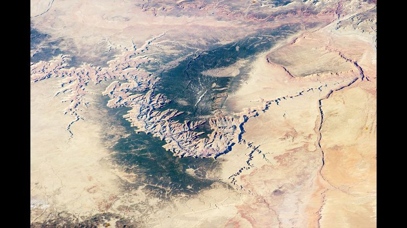
There are dueling theories about the origins of the Grand Canyon, though such was not always the case. Some believe it was carved over millions of years by the Colorado river slowly wearing away at the land. A more recent theory gaining traction is that it was created in a single massive event when an ice wall holding in an ancient Great Lake gave way, and the force of the water released carved the canyon.
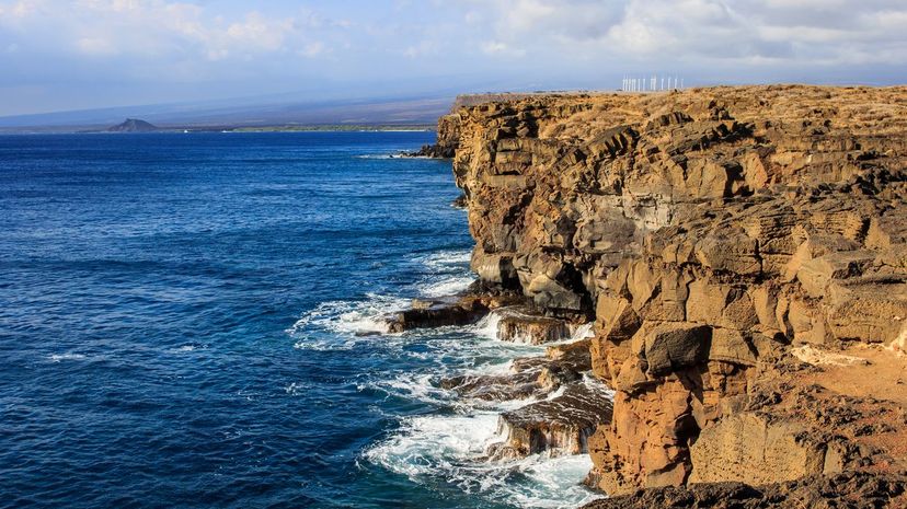
While Brownsville is the southernmost city in Texas, Border Field State Park, California is the southernmost point in California and Key West has a marker pointing out the southernmost place in the contiguous 48 states. Ka Lae, Hawaii is the southernmost point in all 50 states.
Advertisement

While all of these ports are very busy, it is the Port of Los Angeles that takes the cake. The Port of Los Angeles sits on 7,500 acres and covers 43 miles of waterfront. Approximately $1.2 Billion of cargo passes through this port every day.
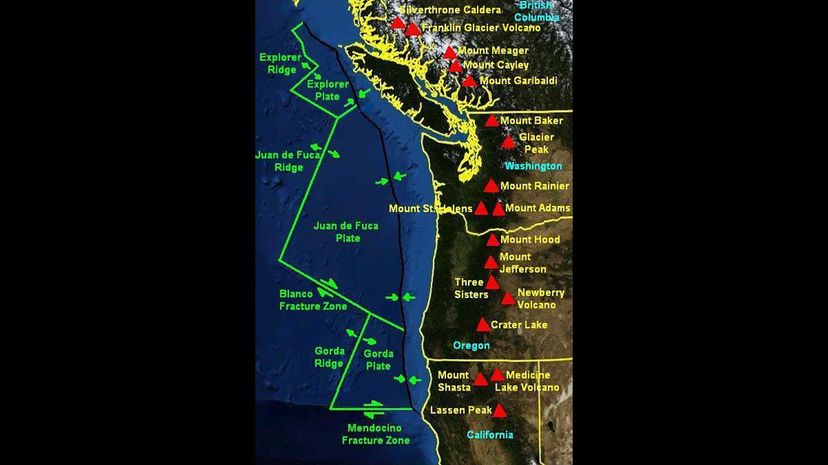
The Cascadia Subduction Zone is a fault line that runs along the West Coast, in the ocean. When it "snaps" back from its subduction action, it causes huge underwater earthquakes, which in turn cause massive tsunamis. The last one was in 1700 A.D.
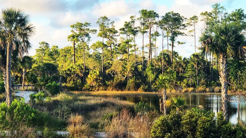
The Florida Everglades, which includes The Everglades National Park, is a massive wetland region and the biggest subtropical wilderness left in the United States. Threatened by climate change, the Everglades we know today may someday exist only in memory.
Advertisement
While all of these forests are huge expanses of natural beauty available for Americans to see, Tongass National Forest is the largest. It should come as no surprise that Tongass National Forest and the runner up, Chugach National Forest, are both located in Alaska.
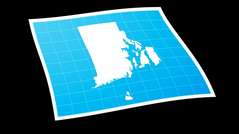
While there are nine states with panhandles, Rhode Island isn't one. Those states are, in alphabetical order, Alaska, Connecticut, Florida, Idaho, Maryland, Nebraska, Oklahoma, Texas and West Virginia.
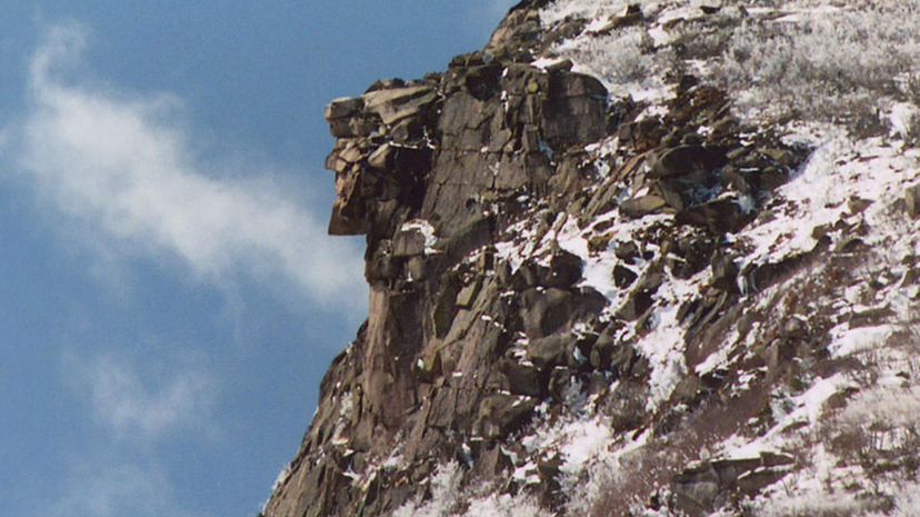
The Old Man of The Mountain was a proud geographic feature of New Hampshire which was, as the name suggests, a rock formation that appeared to be the profile of an old man. Long considered an icon of the state, it collapsed in 2003.
Advertisement
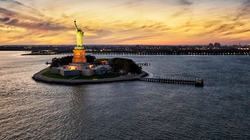
This answer is complicated. Legally, as provided by lawsuits between New York and New Jersey, Liberty Island is in New Jersey, but only below water. All land above water, which is federally owned, is part of New York. Thus, the Statue of Liberty is in New York.
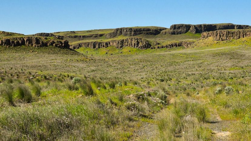
In 1923, J Harlen Bretz theorized that the Channeled Scablands of Washington State were created by a massive dam breaking around an ancient ice lake, releasing a torrent that created cavitation so strong it carved a huge area of Washington's landscape. At the time, Bretz was considered a fantasist, but as of the early 1970s, his theory is the accepted one.
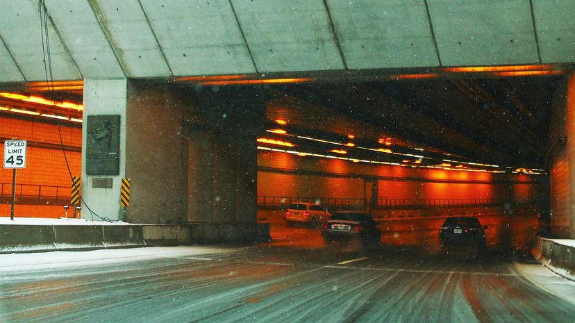
The Ted Williams Tunnel and Interstate 90 Extension, nicknamed "The Big Dig," was a famously long-lived municipal infrastructure project that killed a driver on the day it opened, when a piece of concrete fell off the roof onto her car. It is over a mile and a half long.
Advertisement
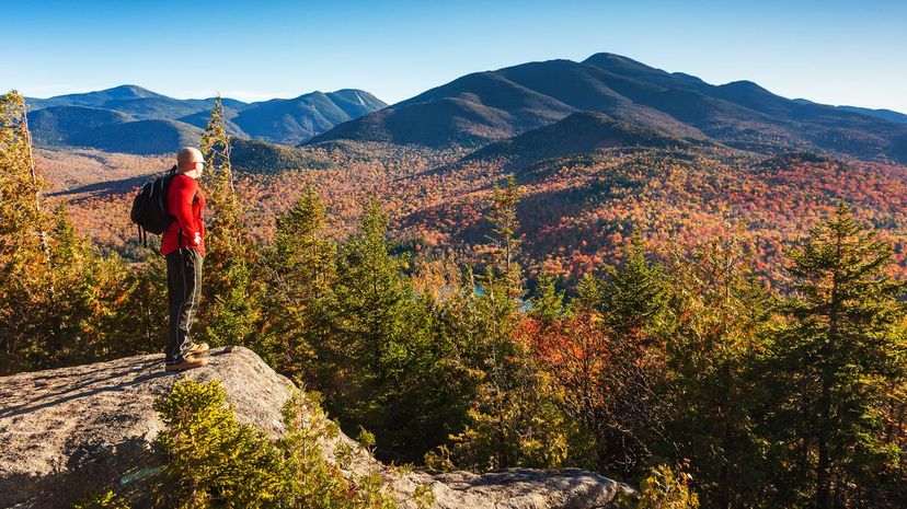
Once the site of the Olympic Winter Games, the Adirondacks are a beautiful range running through parts of upstate New York and Vermont. They inspired hikers to attempt to summit all 46 high peaks, starting in 1918 and continuing to this day. Hikers who achieve this feat become "46ers."
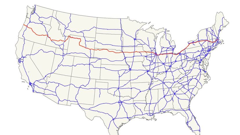
U.S. Route 20 is the longest in the country, measuring 3,365 miles. The U.S. route-numbering system designates routes ending in a zero as coast to coast routes (in theory, anyway), and this one fulfills that promise, going from Oregon to Massachusetts.
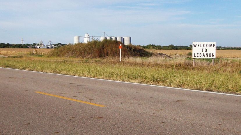
Just over two and a half miles from Lebanon, Kansas is the geographic center of the 48 contiguous states of the U.S. This strange fact, a reason to visit Lebanon, was established by a survey of the country in 1918.
Advertisement
The Great Basin Desert is absolutely massive, at over 190,000 square miles. It is followed closely by the Chihuahuan Desert at 139,769 square miles, the Sonoran Desert at 100,000 square miles and the Mojave Desert at 47,877 square miles.
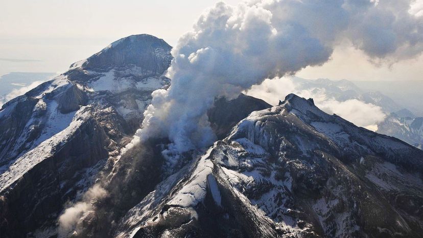
Scientists have been giving special attention to Mount Redoubt since its 2009 eruption, which was preceded by what can best be described as a scream coming from the volcano before silence and its eruption. This was actually a series of overlapping tremors signaling the coming eruption and may lead to better ways of predicting eruptions.