About This Quiz
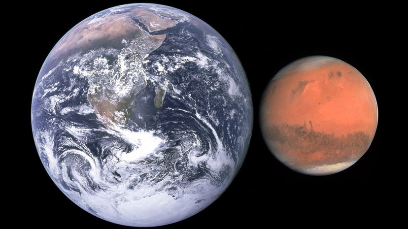
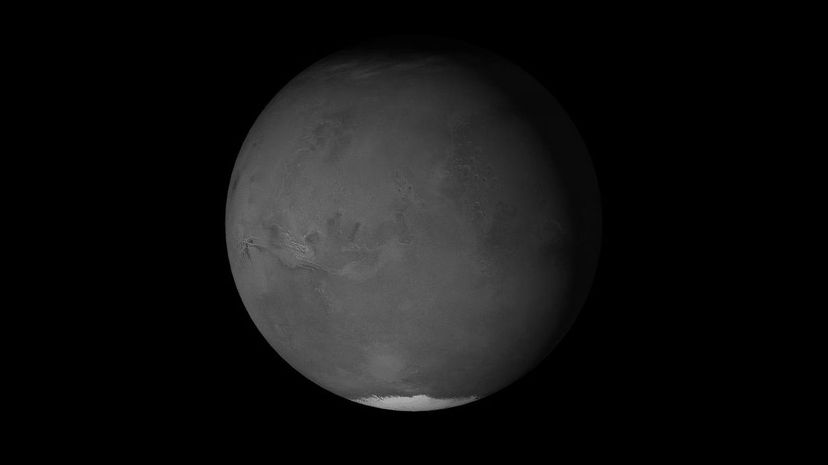
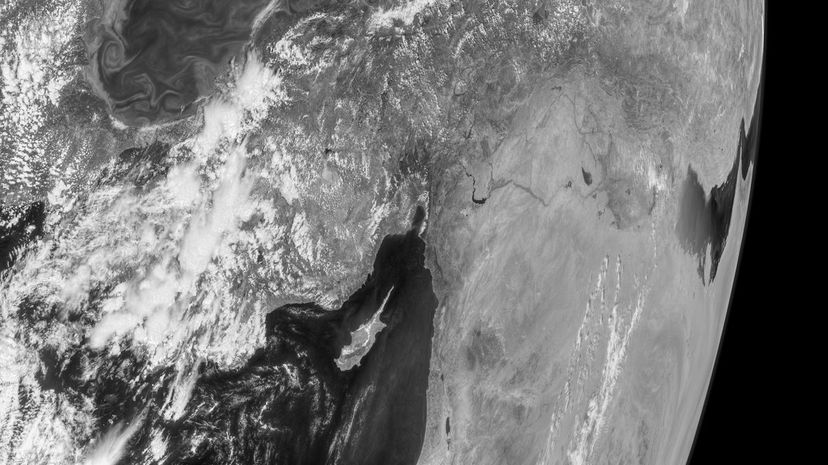
The planet Mars and the planet Earth were born from much of the same cosmic fires, but each took its own path. The Earth is a blue planet with oceans, flora, fauna and a relatively thick atmosphere. Mars, on the other hand, is a barren wasteland with no bodies of liquid water, and almost no atmosphere. Mars is smaller than the Earth, with weaker gravity, and even the geologic forces that shape worlds are different between the two planets.
Humans have had thousands of years to explore the Earth, discovering and naming landmarks and places. Astronomers have only had the tools to even glimpse the red planet in any detail for a couple of centuries. As our tools improved, humans have gotten better and better views of Mars, improving our understanding of its surface, its history, and of course its landmarks. Mars is strewn with vast craters, towering volcanoes and canyons that could swallow nations from Earth. It has vast deserts, glaciers made of solid carbon dioxide and rock formations suggesting it was once a world eroded by liquid water. Mars also has some features that Earth does not have, including rock formations shaped by Mars's unique geology and weather.
Could you separate the Martian landscape from the Earthly one? Now is the time to find out!

The Shanay-Timpishka is a river in Peru within the Amazon Rainforest. Its name translates roughly to "boiling with the heat of the sun". It is called this because its average temperature is 186.8˚F, meaning it's almost but not quite boiling.
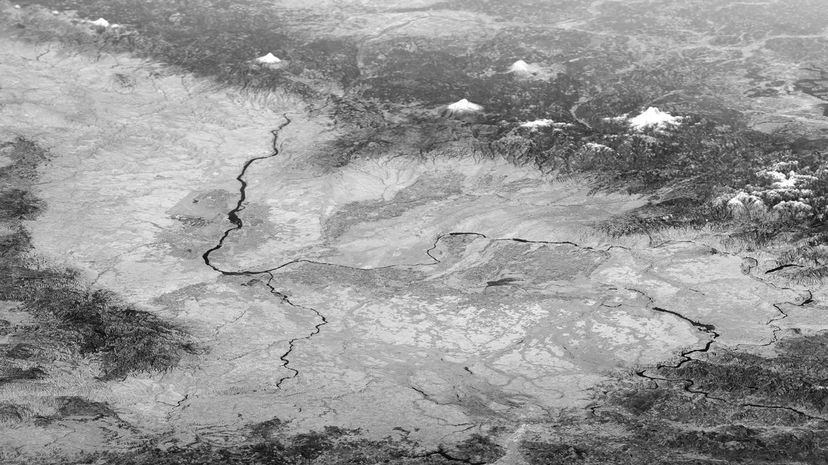
Arcadia is a gorgeous region of southern Greece, once celebrated for its unspoiled wilderness, and now a region known for farming and for its natural beauty. It is named for the mythological character Pan, who was said to live there.
This crater, given the memorable name Airy-0, is a landmark currently used to determine the position of the planet Mars's Prime Meridian, or as Astronomers have namaed it, Sinus Meridiani. The location was chosen by astronomers in the 1800s, but in 1972, NASA determined a landmark that more or less landed on Sinus Meridiani, Airy-0 specifically.
Advertisement
The Amurian plate is a minor tectonic plate in Southeast Asia, commonly omitted from tectonic plate maps due to being relatively small and unimportant. Mars is believed to not have tectonic plates, though it may have had them in the past. Mars does, however, have some geological activity, in the form of "marsquakes".
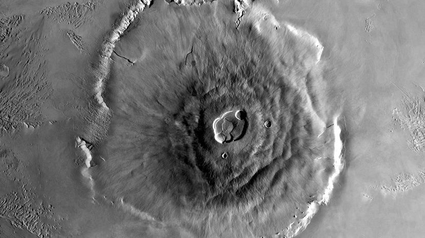
This feature isn't just the tallest mountain on Mars, it's the tallest mountain in the solar system. Called Olympus Mons, it stands 88,580 feet high, or 16.7 miles if you prefer. A shield volcano, Olympus Mons is 374 miles wide and has a caldera 49.7 miles by 37.2 miles wide, and 1.9 miles deep.
Many of the regions of Mars observed by astronomers were recorded in photographic maps taken in strange shapes, since Mars is, of course, a sphere. Called quadrangles, these mapped areas are among the named regions of Mars, and the Arcadia quadrangle is one of them.
Advertisement
The Puerto Rico Trench is one of the deepest places in all of the world, with a maximum depth of 27,480 feet, making that point the deepest in the Atlantic. Created between a zone of horizontal tectonic plate movements to its west and the Lesser Antilles subduction zone to its east, the Puerto Rico Trench is a fascinating abyss right here on Earth.
The Grand Canyon of the American southwest is truly impressive, with a maximum width of 18 miles and a length of 277 miles. Compare this to Valles Marineris, Mars's Grand Canyon, which is nearly 10 times as wide, and so long that if superimposed on the Earth, it would extend from New York to San Francisco.
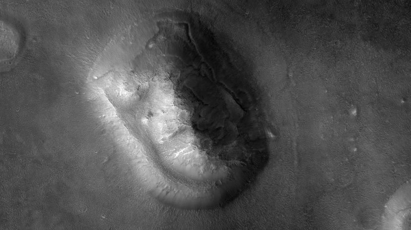
The Cydonian region of Mars is one of the most observed because Earthbound telescopes can make it out at night, because of the angle of Mars to the Sun. One Cydonian mesa photographed by Viking 1 resembled a face in its early photographs, sparking belief among some people that it was the work of aliens. Later images taken with better equipment showed it was little more than an illusion.
Advertisement
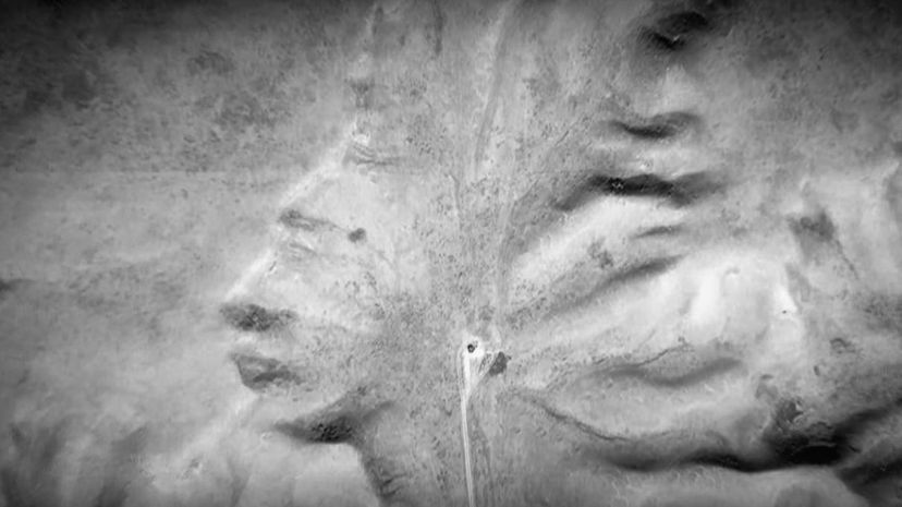
Like the "face" on Mars, Earth has plenty of similar naturally occurring Rorschach test images. Badlands Guardian, a geographical feature in Alberta, Canada, was found to resemble a man in a First Nations' traditional headdress, looking to the west.
The Atlantic rift valley isn't the deepest part of the oceans, but it is the largest canyon on the planet. While not as huge as Valles Marineris, it is gigantic, and consequential for all earthlings.
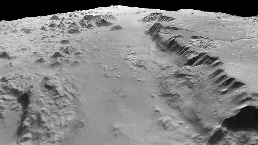
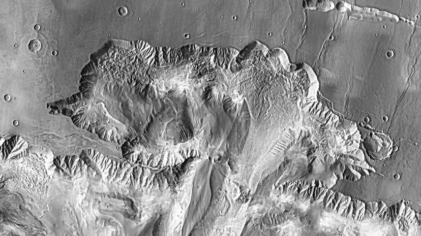
The Libya Montes is a mountainous highland region on Mars, created by a geologic uplift caused by a nearby meteor impact. Because Mars does not have tectonic plates, volcanoes and impacts play a much larger role in shaping the land.
Advertisement
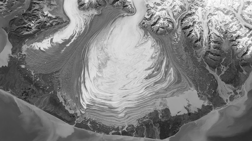
Elephant Foot Glacier is a glacier in the Earth' arctic, located in northeastern Greenland, part of Romer Lake, a huge, freshwater fjord. While much of the observable area of Mars was shaped by glaciers, Earth was shaped by similar forces, many still at work today.
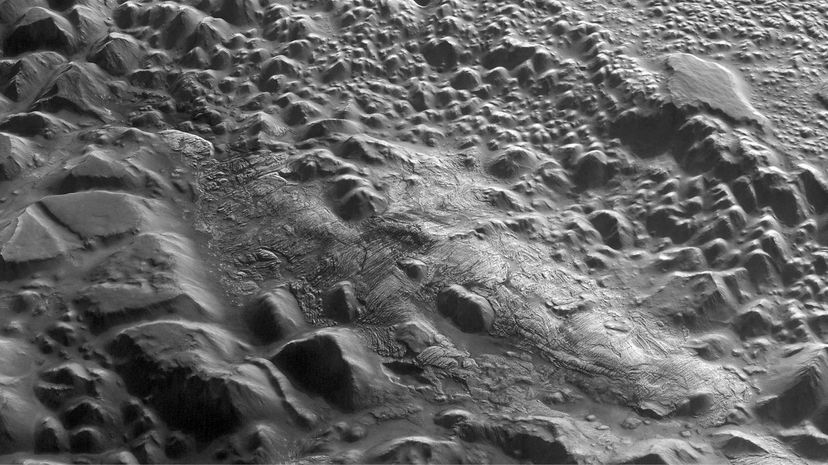
The Iani Chaos is a kind of geologic formation unseen on the planet Earth. A "chaos" is a region so named because of its haphazard rock formations, which came into existence billions of years ago. It is believed these regions were formed by the melting of what was essentially a motionless underground glacier.
Elysium Mons is a Martian volcano located in a region named Elysium, after the afterlife populated by the ancient Greek heroes. In terms of elevation, Elysium Mons is the fourth tallest peak on the planet, but being a volcano, that could change.
Advertisement

Russia's Kamchatka Peninsula extends into the Pacific, forming a far eastern arm of the Russian Federation. Given the peninsula's high mountains, many of which are volcanos, when the moist air blows in from the Pacific, it condenses over the mountains, dumping more than one hundred inches of rain on the region per year.
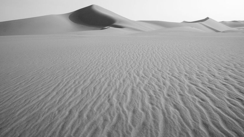
The region of Libya called Fezzan includes some truly breathtaking topography, including huge sand dunes, some centuries old. The region's two truly barren areas, called ergs, are the Idhan Murzuq and the Idhan Ubari.
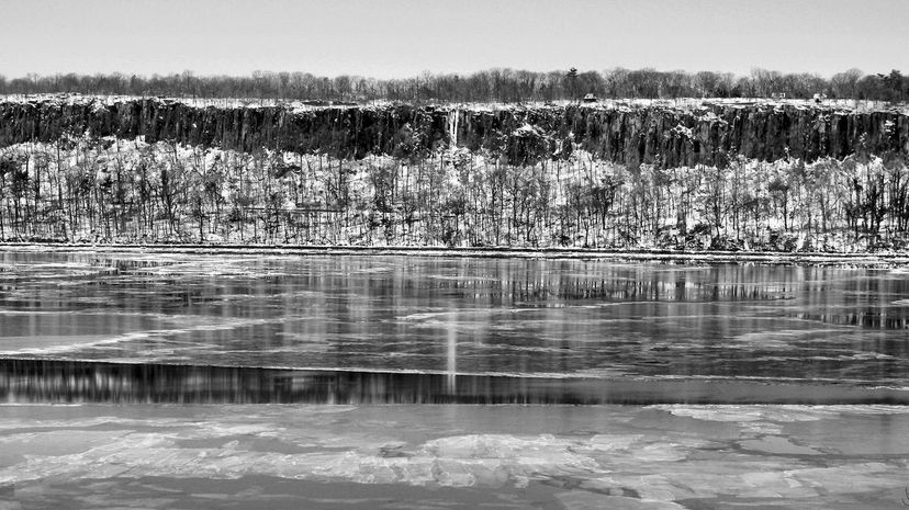
The New Jersey Palisades are high cliffs on the New Jersey side of the Hudson River, in the United States. This feature was not formed by the Hudson River, but by the separation of the North American and European plates in prehistory.
Advertisement
Mars's Mare Erythraeum is one of the earliest regions of Mars named by astronomers on Earth. Early astronomers believed it was an actual sea of water, hence naming it for the Erythraean Sea, the name Greek mariners gave to a region surrounding the Horn of Africa.
Formed during the last Ice Age, the Channeled Scablands are a bleak region of Washington state with strange geographical features formed by cavitation, tiny, highly explosive bubbles formed by fast-moving water. Geologists believe that an ancient great lake, hemmed in by a towering glacier, broke its banks, sending huge quantities of water spilling over this region, tearing at it and creating its features.
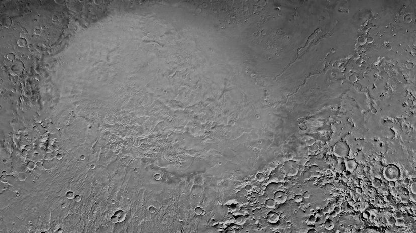
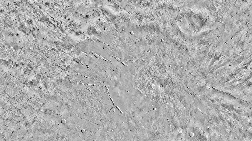
The Hellas Plain, formally the Hellas Planitia, is a plain on Mars formed by an impact crater. That impact crater is the fourth largest in the solar system, depending on how one measures it, and is about 1,400 miles wide.
Advertisement
Sometimes called "The Eye of Mars", Solis Lacus is a dark region surrounded by a region of lighter soil, creating the impression of a human eye, with its white region and pupil. Part of a region known for its impact craters, it is in part the result of the deposit of space-borne materials over time.
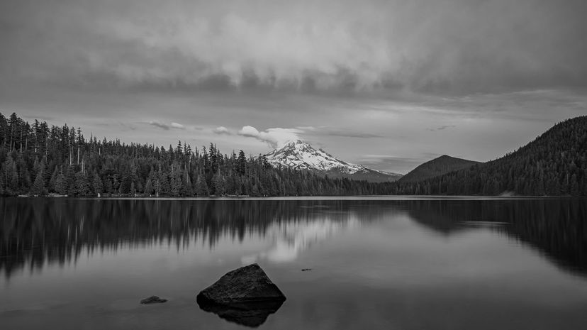
Lost Lake is a lake in Oregon that disappears once every year. Under the lake bed is a lava tube into which the lake disappears once a year. How does this work? The lava tube is always draining the lake, but for a large part of the year, snow melt replenishes the lake faster than the hole can drain it.
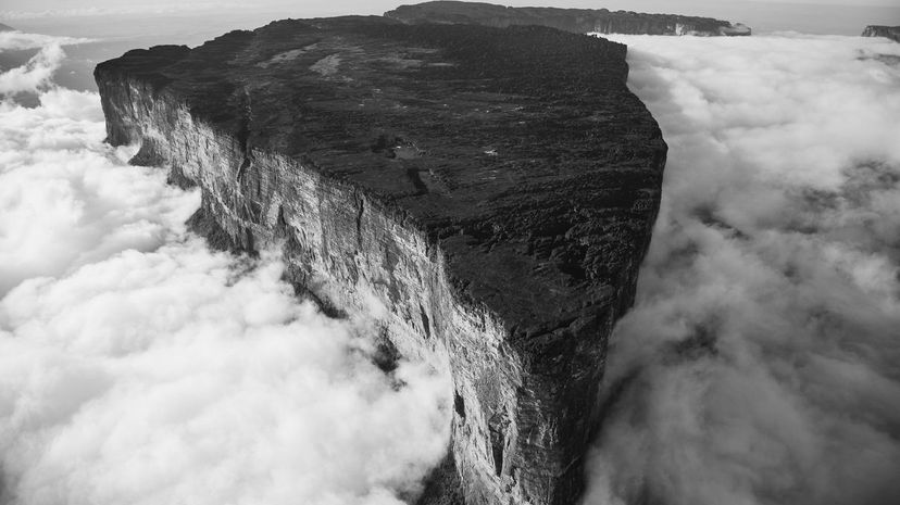
Mount Roraima is a strikingly geometric mountain marking the border separating Brazil, Venezuela and Guyana. Part of the Pakaraima plateau chain, Mount Roraima is the tallest.
Advertisement
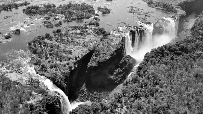
The Devil's Swimming Pool is the name for a section of Victoria Falls in Zambia, where, during the dry season, the falls slow to a trickle, making it possible to swim near the edge of the world's largest waterfall without fear of being swept over. It looks amazing, but if you go there, be careful, as it is essentially a wet cliff.
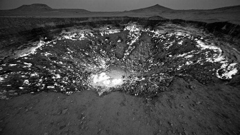
Not all craters are formed by celestial impacts. The Darvaza Crater, sometimes called "The Gate of Hell", was formed by a natural gas fire that caused part of the earth to cave in, creating a fiery crater that looks like the entrance to Hell. It is located in Turkmenistan.
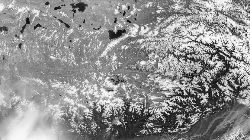
The Tibetan plateau is known as "the roof of the world" and is 16,000 feet above sea level. The biggest plateau on Mars, Tharsis, is approximately 23,000 feet above the height generally agreed to be "sea level" on Mars. This means that if Mars had the same atmosphere as Earth, the air would still be too thin to breathe on the Tharsis plateau.
Advertisement

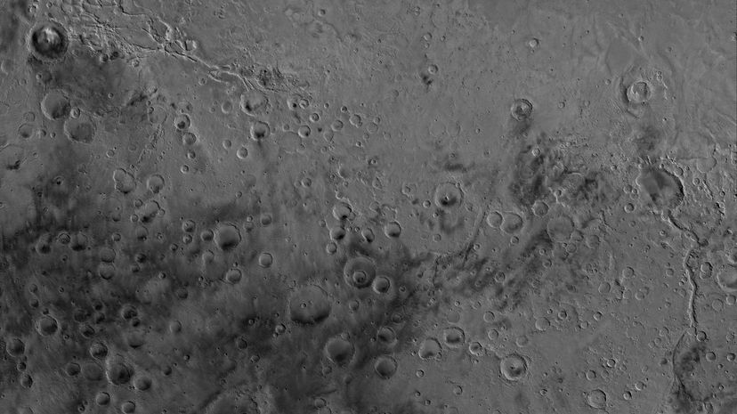
Many theories about Mars's past relationship to water exist because of the vast evidence suggesting it was once present there. The Chryse Planitia, or "Golden Plain" is one such location, specifically because it shows evidence of water erosion, which is particularly interesting because it was formed as an impact crater, which tends to be easier to date.
Ophir Chasma is part of the Valles Marineris canyon which scars the surface of Mars. While some of the canyon was undoubtedly formed by erosion, it is believed it may, overall, be the result of a glancing celestial impact.
The Aeolis quadrangle is one of the regions of Mars photographed by NASA and assembled as a mosaic image. One region of Mars included in the Aeolis quadrangle is Terra Cimmeria, a place named for the home of the Thracians, and according to Robert E. Howard, creator of Conan the Barbarian.
Advertisement
While Tharsis is an equatorial region on Mars, Tarshish, its namesake, is a place on Earth mentioned in the Bible. If you wanted to go there, you'd need to do some research. It is suggested that Tarshish is on the Mediterranean, but there is no proof either way as to its true location.
Both Mars and the Earth have magnetic fields, but they are very different. The Earth, with its internal movement and tectonic plates, generates a magnetic pole, but Mars, whose internal structure changed and no longer has plates, has magnetic regions but no planetary magnetic pole.
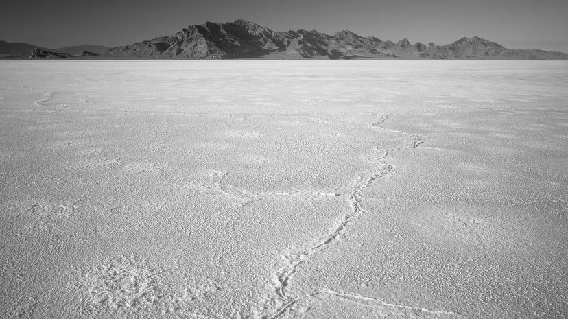
While Mars has a Bonneville crater, the Bonneville Salt Flats are a huge, desolate region in the American west most famous for its association with drag racing. Drivers meet there in organized competitions to set land speed records on the salty surface of the Bonneville Flats.
Advertisement
The Medusae Fossae is a plain region formed by volcanic activity long ago. Situated between volcanic regions, this area is covered with sediment, probably produced by those eruptions. It is named for the Greek monster, the Medusa.
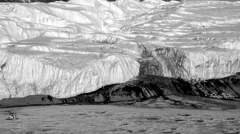
Perhaps one of the strangest landmarks on Earth, Blood Falls is a five-story waterfall in Antarctica whose source is a very salty lake with high iron content, deep beneath the glacier, separate from air and sunlight. When the water comes out of the glacier into the waterfall, the iron oxidizes and the waterfall turns as red as blood.